|
|
|
|
|
 |
Coolgardie-Esperance Highway, South Coast Highway, Chester Pass Road, South Western Highway, Robertson Drive, Forrest Highway, Old Coast Road, Mandurah Road, Ennis Avenue, Patterson Road, Rockingham Road, Stock Road, Leach Highway, Kwinana Freeway, Canning Highway, Great Eastern Highway, Great Eastern Highway Bypass, Roe Highway, Great Northern Highway, Brand Highway & North West Coastal Highway (National Route 1) - Como to Burswood |
Statistics:
Route Numbering:

General Information:
National Route 1 is a major route in WA.
The route varies in form from multi-laned arterial road, suburban road, to single carriageway rural highway. It passes through commercial, industrial, residential and agricultural land, and also through state forest and conservation areas.
Multiplexes along the route include:
History:
Great Eastern Highway , Great Eastern Highway Bypass & Roe Highway:
| Burswood to Como | Como to Burswood | |||
| Preview: | Description: | Preview: | Description: | |
 |
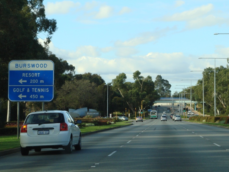
Advance Directional Sign: AD sign with lane allocations at Burswood approaching Craig Street, June 2009. Image © Paul Rands |
 |
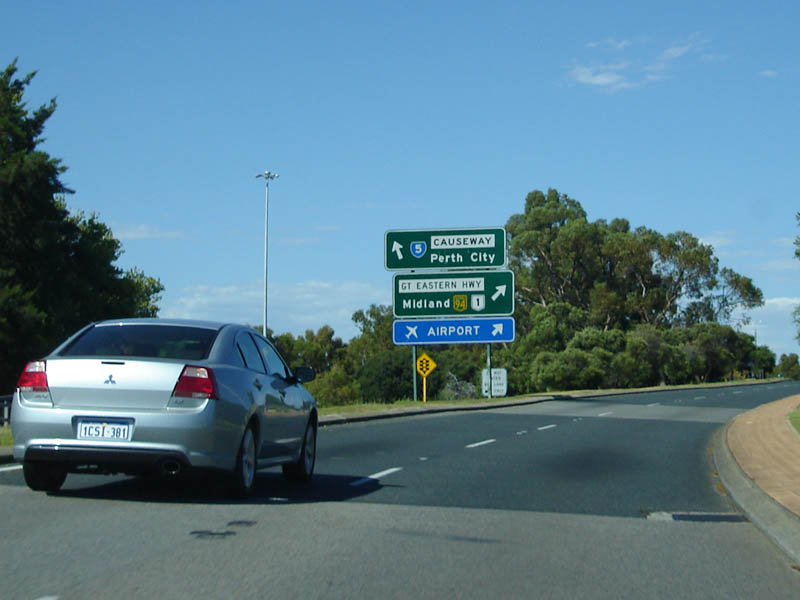
Advance Directional Sign: AD sign on Canning Hwy (NR1 / SR6) at Victoria Park, approaching the interchange with Causeway (SR5) and Great Eastern Hwy (NR1 / NH94). December 2007. Image © Paul Rands |
|
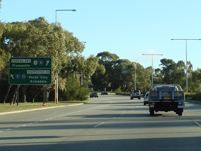 |
Shepperton Road, Causeway & Canning Highway Interchange: Great Eastern Hwy at Burswood approaching the interchange with Shepperton Rd (SR30), Causeway (SR5) and Canning Hwy (SR6), June 2009. Image © Paul Rands |
 |
Supplemental AD Sign: Directional sign for the upcoming Graham Farmer Fwy (SR8). Eastbound at Victoria Park approaching Causeway (SR5). December 2007. Image © Paul Rands |
|
 |
Shepperton Road, Causeway & Canning Highway Interchange: Great Eastern Hwy at Burswood at the interchange with Shepperton Rd (SR30), Causeway (SR5) and Canning Hwy (SR6), June 2009. Image © Paul Rands |
 |
Intersection Directional Sign: ID sign for the Causeway intersection, at Victoria Park, near the official terminus of NH94. December 2007. Image © Paul Rands |
|
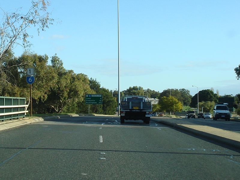 |
Trailblazer Assembly: SR6 / NR1 trailblazer at Victoria Park at the interchange with Causeway (SR5), Great Eastern Hwy (NH94 / NR1) and Shepperton Rd (SR30), June 2009. Image © Paul Rands |
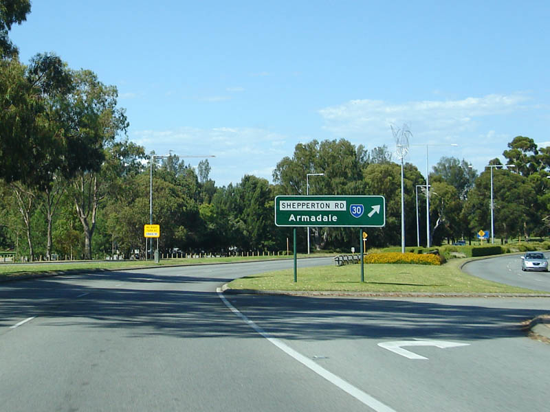 |
Advance Directional Sign: AD sign for Shepperton Road (SR30) at Burswood. December 2007. Image © Paul Rands |
|
 |
Distance Sign: RD sign at Victoria Park, June 2009. Image © Paul Rands |
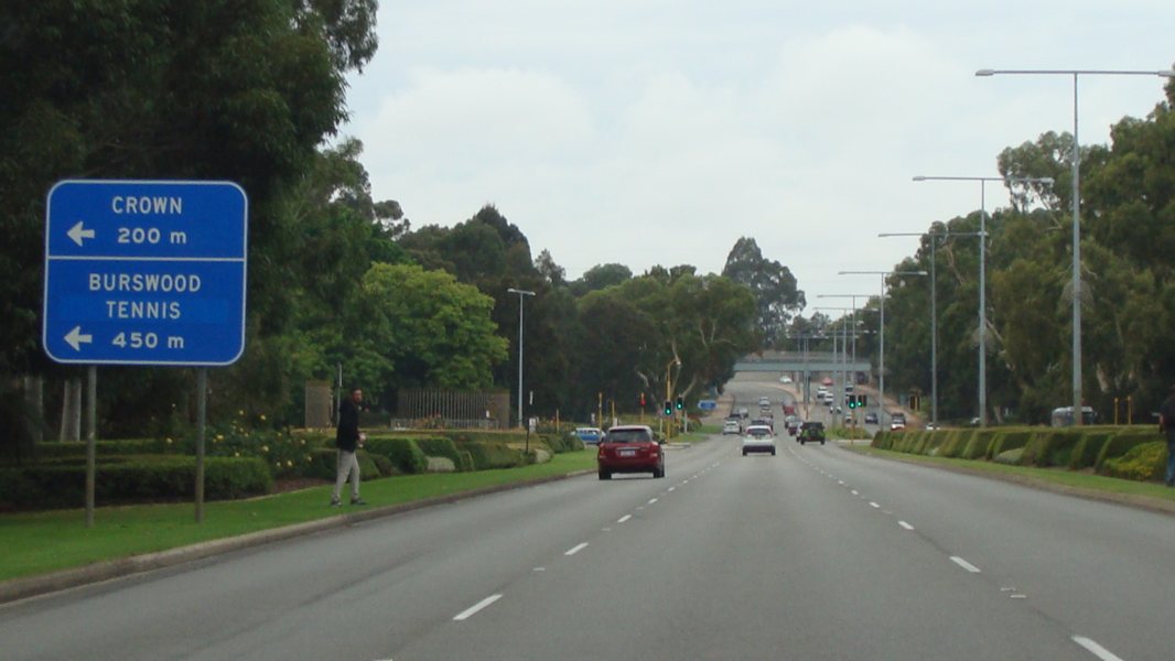 |
Advance Directional Sign: AD sign at Burswood near the Burswood Casino approaching Bolton Av, April 2016. Click here for a photo of this location by Paul Rands from July 2009. Image © Paul Rands |
|
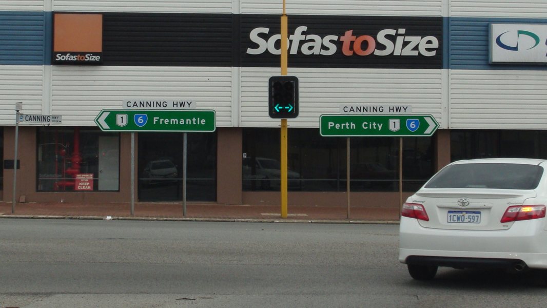 |
Intersection Directional Sign: ID signs on Canning Hwy (NR1 / SR6) at Victoria Park, facing Berwick St, April 2016 . Image © Paul Rands |
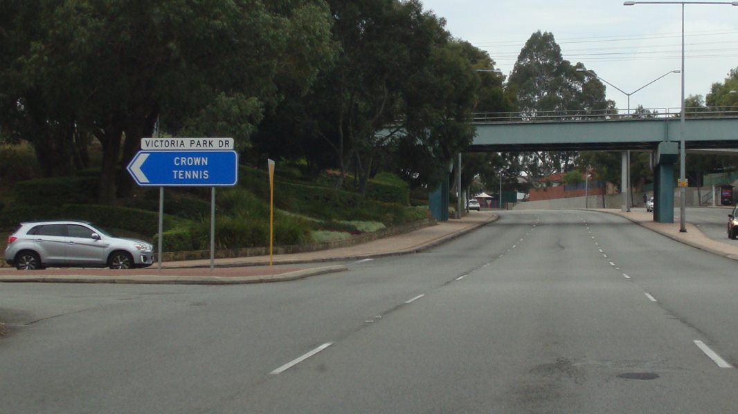 |
Victoria Park Drive Intersection: Corner of Great Eastern Hwy (NH94 / NR1) and Victoria Park Dr at Burswood, April 2016. Click here for a photo of this location by Paul Rands from July 2009. Image © Paul Rands |
|
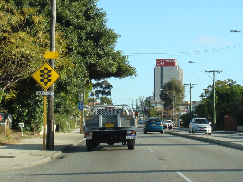 |
Approaching Way Road: Canning Hwy (SR6 / NR1) approaching Way Rd at South Perth, June 2009. Image © Paul Rands |
 |
Advance Directional Sign: AD sign at Burswood approaching Graham Farmer Fwy (SR8), April 2016. Image © Paul Rands |
|
 |
Trailblazer Assembly: SR6 / NR1 trailblazer at South Perth, approaching Way Rd, June 2009. Image © Paul Rands |
 |
Graham Farmer Fwy / Orrong Road Interchange: Intersection with Graham Farmer Freeway and Orrong Road at Burswood. December 2007. Image © Paul Rands |
|
 |
Way Road Intersection: Corner of Canning Hwy (SR6 / NR1) and Way Rd at South Perth, June 2009. Image © Paul Rands |
 |
Graham Farmer Fwy / Orrong Road Interchange: Intersection with Graham Farmer Freeway and Orrong Road at Burswood, April 2016. Image © Paul Rand |
|
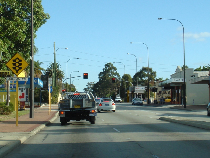 |
Approaching Douglas Avenue: Canning Hwy approaching Douglas Av at South Perth, June 2009. Image © Paul Rands |
|||
 |
Trailblazer Assembly: SR6 / NR1 trailblazer at South Perth near Douglas Av, June 2009. Image © Paul Rands |
|||
 |
Trailblazer Assembly: SR6 / NR1 trailblazer at South Perth after the junction with Douglas Av, June 2009. Image © Paul Rands |
|||
 |
Approaching South Terrace: Canning Hwy (SR6 / NR1) approaching South Tce at South Perth, June 2009. Image © Paul Rands |
|||
 |
Trailblazer Assembly: SR6 / NR1 trailblazer at South Perth near South Terrace, June 2009. Image © Paul Rands |
|||
| Click here for the continuation of NR1 between Burswood and Midland Click here for the continuation of NR1 between Rockingham and Como |
||||
1 Main Roads Western Australia
2 Government of Western Australia, Media Statements, Official opening of Eastern Gateway project, 13 June 1997
Last updated: 10-Jan-2019 21:10
This site © Paul Rands. All rights reserved. Some portions © (copyright) by their respective and credited owners. Permission must be obtained before using any images from this site. For details, please email by clicking here.